

Discover how SMEs use TGB to transform real-world geospatial data into smarter operations, faster decisions, and scalable business intelligence.
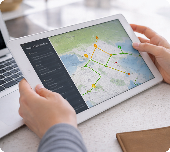
Optimize routes and reduce fuel costs by converting addresses into AreaSeals and dynamically routing deliveries.
TGB enables real-time geospatial data processing, allowing SMEs
to turn raw GPS data into structured location intelligence for efficient logistics. With a scalable geospatial data platform, businesses can continuously optimize routes and reduce operational inefficiencies. This creates a foundation for AI-driven logistics and smarter last-mile delivery.
Analyze customer activity and revenue by area to guide expansion, pricing, and marketing decisions
By using geospatial analytics and location intelligence, TGB allows businesses to see how their geographic data connects and changes. Structured AreaSeals enable consistent analysis across regions, improving decision-making and growth strategies. This transforms raw business data into actionable, AI-ready insights.
Assign technicians based on real-time location and workload, improving response times and efficiency.
With smartSNAPPER and real-time geospatial data capture, TGB connects field operations directly to a structured digital system. This supports more flexible planning, smarter team allocation, and faster reactions. The result is a fully integrated, location-aware service operation powered by real-time data.
Evaluate potential store or office locations using spatial data on demand, traffic, and competition.
TGB provides advanced geospatial modeling and digital twin capabilities to simulate and compare potential locations. Businesses can analyze demand, accessibility, and competition within structured geographic zones. This reduces risk and enables data-driven expansion decisions.